
Take your skis and travel the world.
ANDESQUI - CHILE & ARGENTINA
2017
THE STORY BEHIND
A boucle in South America (Chile and Argentina) can hardly be topped. Skiing here takes place in the highest Andean peaks around the Aconcagua or on the slopes of still active volcanoes. Argentina's northern ski resorts are located directly on the vast and unimaginably lonely and arid Pampas, the southern ones in Patagonia with its lakes and forests. In Chile, the northern ski resorts are part of the catchment area of the metropolis of Santiago de Chile, where modernity and tradition, wealth and poverty, Latin America and Europe meet. The fact that the region is not entirely stable politically and geologically adds to the adventure. An earthquake can occur from time to time - for sure an Argentinean policeman will stand in the way at one of the countless roadblocks - without sufficient knowledge of Spanish this experience has a similar adrenaline factor as an earth tremor of magnitude 5.5.
The trip will take place with the same cast as in New Zealand. But we have an important advantage in Chile: John, returned from Zurich to the city from which his parents fled in 1972, greets us at the airport and helps us with the important things like sightseeing in Santiago, introduction to Peruvian cuisine and Pisco, buying snow chains and coping with the shock after the earthquake that had taken us out of our beds the first night. Muchas Gracias Loco!!!
THE TOUR
Skiing in South America takes place between 32° (Portillo) and 43° (Esquel) latitude (Ushuhaia would be at 54°) compared to New Zealand (39°) and Europe (Pyrenees 41°, USA 39°) thus considerably closer to the equator. On our Andesqui-Boucle the southernmost point was Bariloche at 41° - we had had enough of the Argentine police and the bad weather and therefore gave up the originally planned La Hoya, which would have been the southernmost ski resort. Ushuaia would be a good 2000 kilometers further and only reasonable with a flight. But if you have better nerves or Spanish skills than we did and also have a little more time and a really off-road vehicle (not a city SUV), La Hoya offers itself, especially since from there the way back via Chaitén to Puerto Montt and thus a part of the dream road Carretera Austral is possible.
In total our trip was 3900 km long. On average, the journey in the morning to the ski resorts was 82km and then after skiing we drove an average of 237km to the next hotel. Daily this is 300km, but we also had stages of 650 and 700km. Truly a huge tour!


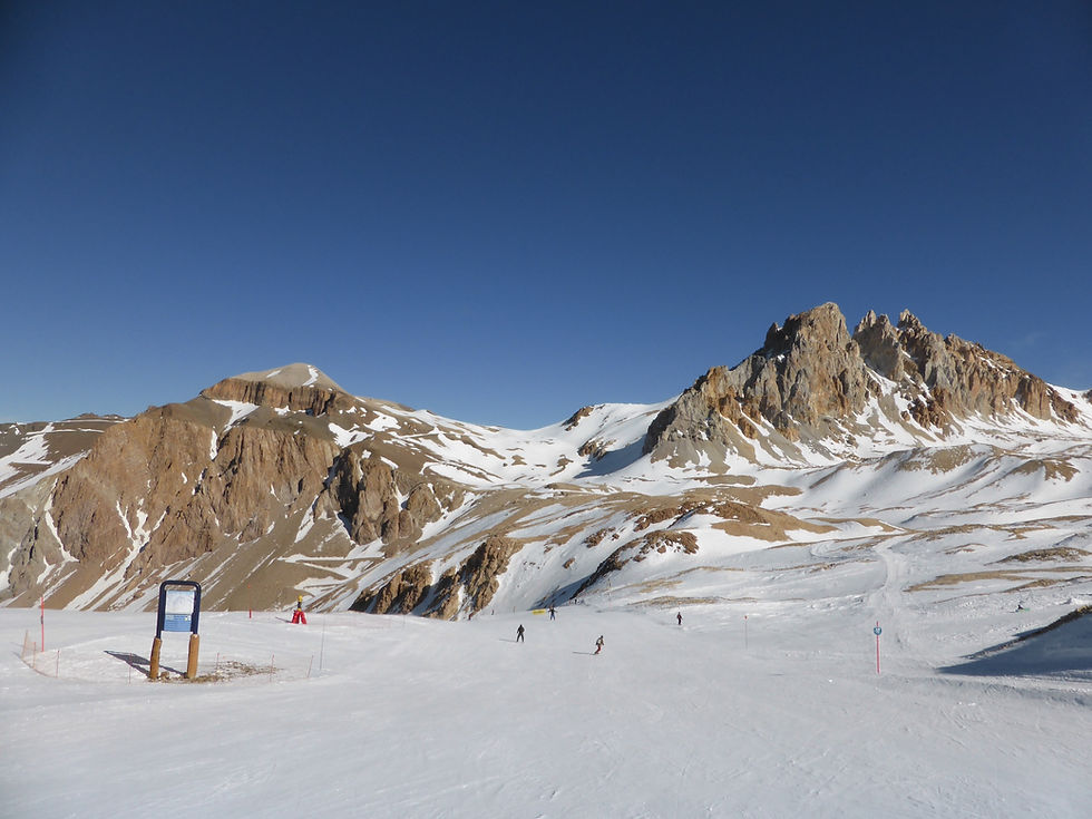
PORTILLO
Lifts 12 - 03/08/2017
PORTILLO and the border
We get up early - today without the help of the earthquake wake-up service. Our goal is to get through Santiago before rush hour in the direction of Portillo, which of course we do not succeed. But we are proud of our first successes (refueling!) without our Locoz-local, who introduced us so well to the local customs yesterday. Special peculiarity: Spanish, que non hablamos.
So we get to enjoy sightseeing from the car, the Gran Torre Santiago always in sight, until we leave the downtown of the 7 million metropolis consisting of many municipalities through the Tunel San Cristobal.
We drive through the northern communities and then turn onto the Panamericana Norte - a neat start to our adventure, we think. The dense population soon gives way to green meadows or vineyards, and always in view, of course, the Andes. After Los Andes, the road leads us into a valley that becomes narrower and narrower, and soon we are facing the first steep wall that the pass road winds up on 30 hairpin turns. Heavy trucks deliver each other overtaking maneuvers, while the smaller cars use every opportunity to overtake the slow trucks: It has something archaic but also very honest, what happens here on the pass road to the Paso Internacional de Libertadores.
Shortly before the top of the pass is our first ski destination: Portillo, still known to us all from the 1966 World Ski Championships http://www.spiegel.de/spiegel/print/d-46414035.html. Portillo consists of a large hotel and two small, interconnected ski areas below (or out of the valley) and above the hotel. Each of these areas has a main chairlift (Juncalillo and Plateau), which are complemented by a few smaller lifts. The attraction here are the three sling-shot lifts, which pull 4-5 skiers up the steep couloirs on one bar - at horrendous speed, but much more comfortable than the rope-tows in New Zealand. This makes couloirs accessible that elsewhere can only be reached on foot - cool stuff! But also the only really cool thing, apart from the summit giants that frame the ski area.
We end the ski day with a plate of pasta in the hotel and make our way over the Paso Libertadores resp. through the Tunel Redentor over to the Argentinean side. There we are greeted by Aconcagua, the highest mountain outside of Asia with 6960 meters. Through very dry high valleys we drive to the border station, where we need 1 1/2 hours to be let over - at the end still the dog was fetched, which showed however cordially little interest in our car. Nevertheless, it was very unpleasant, as it is also the further drive through, on which we have to drive through no less than 7 police checks, whereby we are then actually stopped at the last one shortly before the destination and asked for all papers - and these are many in South America in a rental car driving across the borders.
LAS LENAS
Lifts 12 – 04/08/2017
LAS LENAS
The finca in Eugenio Bustos kept what it promised, even during breakfast and the payment of the bill delayed by 45 minutes, because the very nice but only lady capable of billing had a corresponding delay -- she excused herself with having had an "incident" on the way from Mendoza - about the same policeman? We leave with a Malbec wine gift in the trunk and the corresponding delay. After Eugenios Bustos the Pampa begins, a steppe with zero inhabitants. To make things worse, we get lost twice: First the GPS sends us to San Rafael instead of the and then over a dusty road through a garbage dump (who read 2666? That's how I imagine it in Santa Cruz) and as a highlight it wants to send us through a river (!). Despite all Argentine obedience to authority, which we have already acquired, we mutiny and turn around. Somehow we find the asphalted way over a right bridge and drive in the direction of Las Leñas past a mobile police control to San Rafael and a firmly installed police control in El Sosneado, which wants to know from us where we go. Las Leñas. We are graciously allowed. These controls spoil our mood, so that we can not really enjoy the ride through the beautiful valley to Las Leñas (with an unmanned control station in Los Molles and that is really in the ass of the world and a chain control station, which is also empty for lack of snow about 2 kilometers further). Hope the pictures let us catch up.
Las Leñas itself consists of a dozen similar (army-style) buildings. The base of the ski area is quite large and offers all chicanes (among other things, I have to provide a signature and my passport number in addition to the PIN code to pay for the ski pass).
Las Leñas is the 500th area of my Boucle and I don't want to let it spoil my party mood. The ski area consists of three parts:
-
A beginner area right at the base.
-
A front side, on which half a dozen lifts open up the wide slopes, good snow conditions, countless off-piste variations lead down - really impressive, I would not have expected that.
-
A back side, which is accessed by a lift chain with 4 lifts first through a valley, then steeply over rocks up to 3400m. From up there, a long downhill slope with 1200 meters of altitude and, in
So I come to the conclusion that Las Leñas is a worthy bearer of the jubilee number, a great ski resort with many variants, if there would be more snow.
With some delay to the marching table, we set off - ahead of us are 5 hours of driving on Ruta 40, and it turns out that we are about to be allowed to drive quite a few of the notorious gravel kilometers, probably about 100 kilometers through the loneliest areas, past a handful of huts that seem to have hardly any infrastructure. We are not used to such poverty. A feeling of decadence creeps over us and fights with the panic not to make it out of this desert to the hotel for supremacy. The latter wins (everyone is himself blah blah) and is in turn beaten by the relief that takes us when we find an open door in our apart motel in Chos Malal after all.

CAVIAHUE
Lifts 2 – 05/08/2017
CAVIAHUE
Chos Malal is a good stopover on the Ruta 40 to the south - and to be honest also the only one far and wide. The sky is gray when we get into the car and turn back onto Ruta 40 through an equally gray Chos Malal (I wonder if Argentine villages are more colorful when the sun is shining?). Another stage through the pampas is waiting for us: First 180 kilometers to the south to Las Lajas, then again 100 kilometers to the north to the foot of the volcano Caviahue, where the small town and skiing area of the same name are located. And then 450km to our planned night quarters.
In the meantime snow has started to fall. Under normal circumstances, I am of the opinion that snow makes everything more beautiful and covers the abominations - in Caviahue, I am not sure or otherwise: The fallen snow is not enough for that at the back and front: Half-finished houses stand next to abandoned and dilapidated walls - it really doesn't look like the village is trying for the wakker prize.
The road to the ski resort a bit outside the village leads through a slightly steeper passage, where promptly the first Argentinean chain drama takes place! The gauchos, standing in front of their thick pick ups, laugh about the tourist (?), who hangs crosswise in the road and only with effort drives backwards into the area. We observe both sides, gauchos and tourists. Why I give so much space to this scene?
Caviahue also has a ski area that is two-thirds closed. And the open third goes through beautiful trees. Unfortunately, there is nothing more to say.
We leave the town and the mountains and drive through flat pampas via Zapala, Junin de los Andes (1 police check, waved through) to San Martin de los Andes, one of the most important tourist centers in the Argentine Andes. It is raining.

CHAPELCO
Lifts 10 – 06/08/2017
CHAPELCO and a decision
The day starts wet and cold: It's raining (all night long) and there's no hot water coming out of the shower. Chappeau for the one who showers anyway (It's not me). We drive to the center of San Martin de los Andes at the lake and have breakfast there. There's a choice of coffee and orange juice with either one, two or three sweet croissants or tostadas - for all the lack of imagination, that's still right and on closer inspection, breakfast in France is no more variable.
It takes us about 30 minutes to reach the ski resort of San Martin de los Andes s. Arriving at the base it is raining lightly, it does not look like the precipitation came down as snow during the night. From the base a gondola and a chain of two chairlifts lead to the small plateau of Antuluquen, from where again two lifts lead one floor further up where the highest lifts above the timberline start. What sounds like a lot is actually not: the middle floor is short and the first floor, which is insanely long on the piste map, is one thing above all: flat. Things get interesting at the top three lifts, Silla del Mallin, Silla del Mocho, and Poma del Fillo, which - at least that's what it looks like in today's thick fog - serve consistently short but challenging runs. (A view into the Back Bowls, which it should also have here, is not to be thought of at all). There in the fog the snow is also powdery-soft (if there wasn't a slab of ice underneath), from Antuluquen watery-soft. Telemarking is great fun today on all snow bases. Ok, an improvement compared to yesterday was not really difficult. Still Chapelco remains in positive memory.
Lively we drive the beautiful Route of the seven lakes and pass the fjord-like lakes to the breathtaking Nahuel Huapi, which makes us euphoric: this is amazing Patagonia and we are here! As soon as we cross the border from Neuquen to the province of Rio Negro the euphoria abruptly gives way to disillusionment: On far less than 10 kilometers 4 (!) police controls take place, at all of them cars are controlled: two by the local police, one by the police of the province of Rio Negro and one by the federal police. At the latter we were then subjected to a more detailed check (with a policeman with his hand on a gun in front of the car, while two other policemen signed off our passports behind the car), which brought us to the decision: We cancel our Argentina trip the day after tomorrow and go back to Chile - despite the lack of ski resorts and better weather here in Arg. These permanent controls steal the fun of traveling, we don't need this. Argentina has eliminated the VAT on accommodation costs for tourists in 2017 in the hope of boosting tourism. We recommend other measures.

CATREDAL ALTA PATAGONIA
@ Bariloche
Lifts 14 – 07/08/2017
CATREDAL ALTA PATAGONIA
Today we visit Cerra Catedral, with Las Leñas THE area in Argentina, in turns of numbers of lifts it is even far ahead. Among other things, this is why Bariloche is the capital of Argentine Andean tourism. The valley station, from which 4 lifts pull up, is also something of the bigger ones, which I have seen so far. Countless snowboard and ski rentals rent skis and snowboards (what a palindrome!) to the many Brazilian guests.
The ski area is really great and reminds of Les Orres or Orcières - it covers several sectors over a wide ridge up to 2180m,. Result? 1150 m verticals. We enter the area via the Amancay gondola with a little adrenaline shot: we're already sitting in the gondola, doors closed, when the lift worker takes my skis out of their holders again. Obviously they were stowed too little safe for him. We puzzle a (long) ride long, when I will get them back, but I had to a wait only for 3 gondolas until a guy gets out of the gondola with my skis.
The Punta Princesa sector, which starts at the top station of the gondola, is served by 3 chairlifts and 2 platter lifts (La Laguna very unfortunately out of service). The connection to the rest of the area is unfortunately via a draw path, as the wonderfully inclined slope below the Punta Princesa 3 chairlift had far too little snow for a direct run, as unfortunately (3.) did many other exciting looking slopes. The Nubes sector consists of the chairlift of the same name up to 2100m and a chairlift and a ski lift with park and FIS slope. Then there's a (probably main) sector around Punta Nevada (top station of the cable car) with half a dozen chairlifts and a very very large number of snowsports enthusiasts (and a few nasty looking casualties). And seen from below, on the far right, there's my favorite sector below Punta Condor. Unfortunately the lowest slopes are closed, but the ones that are open are deserted and very nicely sloped.
What makes lift collecting (with telemark nota bene) a challenge are the narrow slopes (still difficult for me to ski with free heels) and the long and extremely slow lifts. The Princesa III is probably the slowest of them all and since I was stopped three times sitting on the Princesa II for the same injury transport (a beer for whoever tells me how that is possible), I pass on the third Princesa and the missing lifts in the sector Punta Princesa, which I had not yet skied at the start of the ski day. And because the only possible valley descent consists of a green slope, where I still have to unbuckle the skis in places and the rain is getting heavier, I also do without the only six-seater chairlift in Argentina. So, enough of the justification.

CERRO BAYO
Lifts 7 – 08/08/2017
CERRO BAYO
Today we first leave Bariloche and then Argentina. But first we have to visit the ski resort Cerra Bayo, which belongs to Villa La Angostura. Shortly before, we are waved out in a police check, first a lady wants to know my age, then a gentleman wants to see our international insurance, which we can then show after a few attempts. We are glad to leave this country soon.
The ascent to the Cerro Bayo valley station is of the muddy kind, it rains all the way to the parking lot. The base of the Ski Boutique Cerro Bayo lies like a jungle station in the rainforest and makes a surprisingly pretty impression. Each of the blue painted houses fulfills a function: Tickets, Baños, Resto, Bar, Jardin de Infantes, Rental, valley station gondola. We are very taken, also by the new gondola lift, which leads to the middle station Cumelen. From there, an older version - at least the gondolas are old - leads to the summit with the beautiful name Estacion Cumbre(dict.leo.org). However, with some delay, because we are stuck for quite a while, the wind seems to be too strong. Time for a nice chat with the fellow driver from Buenos Aires, who has come here for 3 days to ski, usually skis with his family in Ushuaia and praises Valle Nevado as the best ski resort in South America. Save the Best for Last! At some point, the gondola continues and us to the top - after us, the cable car stops operating! We certainly appreciate this good fortune, because the descent from Cumbre is a beautiful one; with a little better snow and local knowledge, the ridge would even offer many off-piste variations.
The other lifts that are still running are distributed around the middle station and open up moderately difficult but beautiful (and partly short) descents. The downhill run - a wide aisle lined by the gondola lift on the right and two chairlifts on the left - is then once again a highlight in itself.
In pouring rain we leave this jungle camp and make our way to the border, which we cross with a small lap of honor and without waiting - there is also no one else on the way - first the Argentine and then the Chilean, in between there are 39 kilometers of driving over the Paso Internacional Cardenal Antonio Samore, which with its height of 1321m lies below the snow line. In Chile, storm and a power outage in the cabañas await us. Fortunately the stove doesn't need wood and the shower runs on gas. Oh yes, police checks in Chile: zero.

ANTILLANCA
Lift 1 - 10/08/2017
ANTILLANCA
The ski day 9.8. is a victim of the storm. The areas are closed (Osorno) or only a little bit open (Antillanca, 1 lift). Thus we undertake just a trip in the direction of the Volcano Osorno with the hope to see a little bit of the volcano, but..... well.
As a highlight, the hot tub was heated up for us - with a mediocre heating success, but the effort of the people of the cabañas was impressive - muchas gracias also at this point.
Today the storm is over, but nothing has changed regarding the lift status: Osorno completely closed, in Antillanca at least two lifts are running (according to WCS 1 lift). So we drive up there, first along Lago Puyehue and then through a jungle up to the foot of the ski area. This station is also in the jungle, which clears only a few meters further up. Unfortunately, most of the lifts are closed - it can't be the wind, nor the snow. Probably the operation of further lifts is simply not worthwhile, even if we are surprised about the perhaps hundred snow sportsmen - we did not expect so many people. One lift with two slopes, left and right along the lift path - so the story is quickly told. Potential for more would be there: 95% of the area is treeless and doesn't seem steep enough for avalanche danger. Next time then!
We drive off in the direction of Pucon through super rain - but when we arrive here it's dry again. Tomorrow too?

PUCON
Lifts 2 - 11/08/2017
PUCON
Also today it is cloudy and rainy with sunshine, but also today at least it does not storm. Since we get breakfast not before 9:30 (sic!) we have a chill start in the day. We want to ski the volcano Pucon, well at last the skiing area on the northern slopes. The ascent through the rainforest leads over the worst road on this boucle so far. Uncountable potholes are covering the track built on volcanic ash.
At the very end we are allowed to drive over a snow-covered piece - it is sleeting a bit. The snow situation at the valley station then also looks promising, so ticket bought and the chairlift climbed. This pulls slowly and only with little altitude gain through snowy beech tree forests in increasingly dense fog. At the top station there is hardly anything to see, and certainly nothing of the volcano. Two ski lifts are open, the other lifts are stopped. Even though I don't see much, I think I can claim to have seen the ski area. The slopes are all flat, so the challenge is the lack of visibility. Impressive the number of beginners (often also here from Brazil) who practice here on the mountain. My conclusion: Pucon is
the ski resort with the best snow conditions but the most boring runs of this Andesqui-Boucle.
Oh yes, and then I saw the first telemarker of South America.
Back at the parking lot the sun shows up briefly through the fog, but the wait is not rewarded, the fog gets denser again. We drive back to the pretty town of Pucon for lunch and then to Curaucatin in Araucania. Let's see tomorrow if we see anything,

CORRALCO
Lifts 4 – 12/08/2017
CORRALCO
The small hotel in Curacautin has done it to us. Rooms and food are kept simple, there is also no license to serve alcohol - what a contrast to the tourist metropolis of Pucon
.
Curacautin is the starting point for two ski areas: Las Araucarias and Corralco (and also for several national parks). Since we can only visit one before the announced massive bad weather front, we have to decide. And like Swiss Ski 2014, we decide on Corralco.
The road soon approaches the snow line and so it doesn't take long until a policeman is standing on the road. This time it's not about papers but about the question four-wheel drive yes or no. And since our answer is "yes" we are allowed to drive on without chains. The road goes through the wonderful Chilean Araucaria, trees that look like from another time, with mighty trunks and hard small leaves, mostly only in the treetop. And through such snow-covered trees we drive, first still in the fog and then a short distance under blue sky towards the volcano Lonquimay. Finally we see a volcano in all its glory and also the Corralco ski area (1450-2400m), which stretches up the flanks. Joy reigns, as a Swiss Ski president once said!
The joy also continues, although it quickly becomes clear that the top lift (Cumbre) has closed - as it turns out rightly, the storm in the upper sections is massive - the bad weather sends its messengers ahead. Even if the Cumbre lift would have been the icing on the cake, we are having great fun skiing, finally good visibility and good snow conditions! The slopes at the Navidad and El Vulcan lifts are pleasantly inclined, as are the off-pist runs. The latter are mainly at Navidad (and even, at Cumbre). For the beginners, there are the La Cornisa and El Cruce lifts.
Compared to yesterday's area of Pucon, Corralco makes a solid impression - as we will learn later, this impression is not deceiving: Pucon was closed the last few years, so the somewhat run-down image that made the station, was also due to lack of investment.
With good vibes we leave Corralco and head for the 320 kilometer long way to Chillan, towards the rain and storm. After all: This day cannot be taken away from us by the next announced low pressure area.

NEVADOS DE CHILLAN
Lifts 11 – 14 & 15/08/2017
NEVADOS DE CHILLAN
The forecasts came true: On August 13, it rained cats and dogs, the roads were under water and as our contact on the ground told us: All lifts were closed. Since we anticipated this correctly, the 12th was in retrospect the right moment (and place) to get to know the drink Pisco Sour in Apres Ski at the hotel in Chillan. Good is check out at 12 noon. Bad is time change to Chilean daylight saving time (minus 1 hour). The storm rages fiercely as we leave and make our way through puddles of water to the shopping center. We have booked two nights in a cabaña (very important this ñ) - ready restaurant. The 15.8. is a holiday in Chile, many Chileans make the bridge and spend the long weekend in the mountains, difficult to find something.
When we arrive the snowfall is just over, some snow lies on the roadside. In the settlement of Los Lleuques people are standing on the road waving the cars to the side of the road. Chains are mounted on the car in front of us. The man, dressed in black, says something with hablahabla "Cadenas!!!" We point to the navi, only 2 kilometers to go. He insists "Cadenas!" We point and see that a car without chains is driving on. It dawns on us: this is not official directions here. In our most dazzling Spanish, we say "No Cadenas, 4X4" and continue on. There is no snow until we reach the cabaña, we arrive without any problems. The next day we understand the system: In LasTrancas in front of the police station there are dozens of people ("chain mafia"), circling their arms and indicating that they would lend chains or put on chains. For some money, of course. At the police station is the sign "Uso de Cadenas Obligatorio". We stop briefly, then tack on a Chilean also without chains and drive through the checkpoint, the policeman is just taking care of a bus and pays no attention to us. The road remains flat for a long time and rises more steeply at the end and is also snow-covered there, nevertheless no problem up to the lower parking lot at the Plaza de Tata (lowest entrance to the skiing area). With 4X4 and all-season tires so doable.
The ski area is freshly covered with snow, the clouds are still hanging in the mountains. We drive up to the "main square" of the area, Plaza Otto, where there are a few beginner lifts and quite a hustle and bustle. The ski area stretches in two rows of lifts relatively narrow up to 2400 meters, at the foot of the two craters of the very active volcano Nevados de Chillan, the craters Chillan Viejo (3122) and Chillan Nuevo (3186), currently at risk level yellow. On the latter, according to the plan, one could also do catskiing - not in operation here.
From the Mirador lift, the longest run in the southern hemisphere, the Tres Marias slope with 13 (correspondingly flat) kilometers (golf would probably be a bit longer), leads in an arc back to Plaza Tata. But the real joys are at the Otto lift, which opens up a very nice and quite steep freeride area. In this takes me El Fred El, the previously mentioned local, who for some years in Chile his ski instructor thing that he used to do in Scuol - a very great pleasure to see him again and to accompany him on two descents, partly through small valleys with a strong smell of sulfur!
The ski area is great, the decision to spend two days here turns out to be the right one, especially since on the second day the sky is cloudless - and for some reason there are much less people on the slopes (according to El Fred, because the Chileans partied until 3 am with Asado and Cabernet Sauvignon).
So we pack up our stuff as the Chileans hit the dirt road and start the 500 kilometers to Santiago, our last town. The visibility is great, and the further north we go, the more impressive the Andes build up to the east. If the peaks at Nevados de Chillan are still 3000 meters high, they rise to over 5400 meters at Santiago (Cerro El Plomo). A massive white wall, which limits the horizon.

LA PARVA
Lifts 11 – 16/08/2017

VALLE NEVADO
Lifts 12 – 16/08/2017
VALLE NEVADO & LA PARVA
Santiago
We drive through Santiago in the morning traffic - it took us a good hour to cover the 7 kilometers from Macul to the Costanera highway in downtown, from where it's a brisker ride along Avenida Kennedy and through the posh town of Las Condes to the foot of the Andes. The route to the ski areas is not really well signposted, but we find the entrance to the impressive road over about 2200 meters of altitude up to the areas - past an impressive branch of the chain rental company, which has placed half a dozen containers at the roadside, but today probably makes little turnover. We wonder if they would really put chains on us if we asked for them - and then let us creep up the slope for 35 kilometers. The road leads over 39 hairpin bends to the junction in Farellones, where we decide to take the turnoff to Valle Nevado, the other decision would have led us to La Parva or El Colorado. Just before the station, built in the best French manner, there is actually a short piece of snow-covered road, blown away by the snow, and promptly a few drivers have to put on chains - for about 150 meters of road, what a hassle.
We arrive at the valley station without any problems. It's pretty quiet here, the holiday is over - which means it's a little one for me after all, because I can use my Mountain Collective season pass that I bought at the end of 2016 for the US and Canada, which is valid here. I like!
Valle Nord
Compared to the piste plans used for preparation (2014), the area presents itself quite changed. A gondola lift leads from the parking lot up to the unnamed piste restaurant, from there it continues with the Andes Express (finally a disengageable chairlift - the other one in South America is in Bariloche, and I skipped that one). At the top station, a breathtaking view opens up into the mountains, which are far more than 4000 meters high, and which in turn are overlooked by the 5430 meter high giant El Plomo. Never before have I skied in front of a higher mountain - or never before have I felt so small.... The Valle Nevado area consists of two sectors: the front sector, a basin at the foot of the Andes peak accessed by the aforementioned Andes Express, has a handful of smaller lifts on its northern flank - towards the station - that provide access to both beginner and racing slopes. The rear sector in an open high valley offers four lifts with nice slopes on the south side and the Tres Puntos lift on the north side up to 3600 meters with different variations and great views. Valle Nevado is great fun and offers skiing on an alpine scale, even if the sheer size of the ski area is not really comparable to the big destinations in the northern hemisphere.
La Parva
To experience the full dimensions of the ski area, I drive across the invisible border to the ski area of La Parva, which has a completely different character. Wide slopes are accessed by pomas and chairlifts. The view from La Parva goes down to Santiago and is one of the most beautiful I have ever experienced. The area is even quieter, even fewer people here. While Valle Nevado with its international reputation is visited by numerous Brazilian ski tourists, Spanish is predominant in La Parva - and English: On the one hand due to the ski racers from the USA and Canada, who train here giant slalom and downhill, on the other hand by some freeriders and telemarkers. I buy a half-day pass and start collecting lifts. I like it very much in La Parva, some steep slopes in the lower part and open slopes above show some potential with better snow conditions. Unfortunately, the lifts are all slow, so I run out of time, but this again suits me: El Colorado seems to be the area with the worst snow conditions, moreover, only the back ski lifts - which are very very close to the lifts of Valle Nevado - are exciting, so I refrain from buying a day ticket here as well. Still, it's a shame that the operators don't make a common cause and offer a joint ski pass. If the areas were connected, it would indeed be the best ski resort in South America. But so I'm not sure: Bariloche and Las Lenas offer quite a bit and especially they offer more vertical meters (about 300).
HELPFUL THINGS
I hope you find some of my experiences helpful for your planning. The most important information (in my opinion) is about the car, as there is police everywhere.
THIS IS A GREAT PLACE FOR YOUR TAGLINE.
Season/Temperatures/Snow Conditions
Season is from mid/end June until late September or even later. The weather during our stay was spring to early summer in the north (Santiago and Mendoza) and slightly colder in the south. Those staying in the ski resorts themselves will have winter. Three weeks before our arrival in early August 2017, Bari-loche had temperatures of minus 20 degrees, and Santiago was snow-covered. So Arctic cold air blasts are always possible. On the mountains, a strong wind blew most of the time, sometimes so stormy that the lifts were closed. Our trip was also characterized by a 9-day phase of bad weather, during which low-pressure area followed low-pressure area and we were only given short windows of good weather of a few hours (Antillan-ca, Corralco). Without having in-depth knowledge, the weather seems to be more stable in the north than in the south - interestingly enough, this does not mean that the more southern the better the snow situation: Bariloche, Antillanca, Osorno had rather less snow, Cerro Bayo, Pucon, Corralco and Nevados de Chillan more, Portillo and the areas around Santiago were also white (though not deep snow), while Los Penitentes, perhaps 20 kilometers from Portillo on the Argentine side of the Paso de Libertadores could not show a small patch of white.
Convenience
Skiing in Chile can be complemented with hot springs similar to Japan. However, we did not find baths like the Japanese onsen. Often the springs are marketed by hotels, where you can also enter as an external guest (and with a day pass you even get a reduced entrance fee, like in the Termas de Chillan). But it does not seem quite as relaxed as in Japan. Often you will find cabañas that offer "Tina Calientes" - wood-fired hot pots that stand in the garden and sometimes offer a great view.
The service in the ski resorts is of European standard, all facilities can be found in the valley stations (ticket sales, ski rental often with store, restaurant). In the Chilean ski resorts there are many rental stores on the way to the resorts, which rent snow sports equipment or clothing. Due to the South American way of attracting attention with colored flags at the roadside, these rental shops cannot be overlooked. In Argentina, the rental shops are located directly at the valley stations. Language is usually Spanish, English in exceptional cases. But the few words needed to buy a ticket can be learned.
Cash or credit card?
This is not an easy question. Credit cards are widespread and largely do not work. You get used to the fact that you have to write your passport number on the receipt every time (and once also your phone number, if I understood the lady's instructions correctly), and you also get used to the fact that in Chile you are constantly asked whether you want to pay even the smallest bill in quotas: payment by installments is widespread here. We had once at a gas station kiosk problems with the credit card, but with two (better three) card issuers one is largely on the safe side (American Express is a good addition). Argentine pesos are not available at all Swiss banks due to the high volatility (actually due to the constant devaluation). Nevertheless, it is not possible without cash: For smaller expenses like parking and tips at gas stations you should have cash, in Chile the highway tolls are to be paid in cash. We did not use debit cards, we did not withdraw money. Still, we ended up carrying too much cash. But better than the other way around, right?
Accommodation & Food & Water
Accommodation is easy to book through the usual hotel portals, except for the small towns in the pampas. For overnight stays in Las Trancas before Nevados de Chillan, it is not quite as easy because the systems do not find the place. In Santiago, we found inexpensive accommodations via Air-bnb. Breakfast is not always included. Sometimes breakfast is brought to the apartment. I am usually finicky about water. Especially in Argentina (Chos Malal and Eugenio Bustos), the was-ser was excellent. Except for Santiago, I would drink the water everywhere.
In the cabañas there is often only a Swedish stove that heats the living area, the beds are correspondingly cold, sometimes even the hotel rooms are only slightly heated. I was therefore more than once glad for my silk sleeping bag.
In the ski resorts there is always at least one hut, plus there are usually restaurants and bars at the valley stations. I guess you could also call it Aprés Ski. Did I mention that the music was very appealing everywhere? Aprés ski is carried out here very cultivated and abstains from the noise in the alps.
Ski rental
All ski resorts have ski rentals, in Chile you can find them already on the access road at the side of the road. Ski clothing is also rented - so spontaneous visits are possible, there are no more excuses! About the quality of the rental equipment I can not make a judgment, but on the slopes we have seen consistently contemporary material.

I am a Swiss based world travelling skier.
Born 1971 in Switzerland.
First ski experience in 1975 in Leysin.
Visited 640 resorts and skied more than 5500 lifts
You can find the actual statistics here: Liftstatistics
I am an amateur, meaning, that I have real job and I am not paid by anyone for my ski trips. I even paid the tickets by myself (exceptions were Glacier3000 and First).
For feedback, ideas and other topics, send me an email roger.gfroerer@gmail.com
I look forward to hearing from you.
More about me
Driving (attention!)
Access roads
The access roads to the areas are often adventures for themselves. In Argentina, sometimes endless driving through the pampas is necessary (Las Lenas and Caviauhue). Access roads over mud or gravel roads with huge potholes are the rule (exceptions Santiago, Portillo, Nevados de Chillan and Bariloche), sometimes they are impressive (Portillo, Santiago) or simply beautiful mountain roads (Antillanca, Las Lenas). The parking lots closer to the valley station are partly chargeable (Nevados de Chillan, Barilo-che, Las Lenas, Cerro Bayo), we had no problems to find the parking lots. Chains are compulsory for the access roads in both countries: you have to carry chains with you. Chains can be rented at all access roads. In Chile, we were sometimes penetratingly forced to stop by the "chain mafia" (o-ton El Fredl), so that they could rent or put on chains (cadenas) for us. We bought the snow chains in Santiago at an Easy store, so we could skip the mafia. The purchase price was a little more than twice the daily rental fee for chains.
Driving in Chile
In Chile, the highway is subject to tolls, around Santiago the toll is calculated electronically. The roads are asphalted. We saw a lot of ra-dark controls especially on Ruta 5. Since the Chilean police cars usually have their warning lights on, these controls can often be seen from far away. Even if the driving behavior of some Chileans suggests otherwise, it is probably worthwhile to adhere to the speed regulations. We did not take the chance. In part, similar to Argentina, the police stations are located directly on the road. We have seen only one control, otherwise only on chain obligation was pointed out or evenly on the exemption of it with 4x4. By the way: alcohol content is 0.0, which can affect apres ski and choice of lodging.
Driving in Argentina
In Argentina the roads are free of charge, but in every town the police station is located directly at the main road and carries out permanent controls (in the province Neuquen a little less than in Mendoza and Rio Negro). You will get used to the orange marker hats that announce a control in the middle of the road - or not. Sometimes a mobile control appears somewhere in the forest. Once we were asked how old we were and we had to show our international insurance, which we managed after some confusion. Another time (federal police) our passports were copied and the first time we had to show all the papers we had just before our destination. By the way, the Argentineans are the worst drivers I have ever experienced. They always overtake with the firm conviction that there will be no oncoming car - which is often the case on the lonely stretches of road. Nevertheless, always driving a little to the right and expecting that a gaucho in time trouble will just overtake a truck in a bend is certainly not life-shortening. For a skiboucle, Ruta 40 is the most important route. It is unpaved between Eugenio Bustos and Las Lenas, but can be bypassed (be careful in San Rafael, Google Maps showed us a route through a river. Recommendation: at the traffic circle turn right to 25 de Ma-yo and after the village turn south again, do not stay on the 158, or then through San Rafel). You can't avoid the part between Bardas Blancas and the junction of Ruta 40 and Ruta 221, about 100 kilometers on gravel, partly with potholes, but often good to drive, in one of the loneliest areas I've ever been to. Only there you are already 2 hours from Las Lenas, had already a four-hour journey from Eugenio Bustos in the morning and a day of skiing in a great area behind. On this part there are no overnight accommodations, only in Buta Ranquil , so that is to persevere and enjoy the solitude. Sometimes you see a light at the roadside in the darkness - there are already people who live there in the simplest conditions, in an absolute emergency you would certainly get help there even without knowledge of Spanish.
Rent a car: Attention border!
The Andesqui is hardly manageable by public transport, a car is mandatory. Since the roads to the ski resorts are as described bad, to drive with the all-season tires reasonably safe on snow-covered roads and to sometimes avoid the chain obligation, a 4X4 is recommended if possible with a slightly higher wheelbase because of the thresholds in the towns and because of the sometimes massive potholes on all roads, tarred or gravel (except highway). However, it is very important to discuss the planned border crossing with the car rental company in advance. It needs papers for the customs and an international insurance, also in a separate pa-pier. These papers were requested several times at customs and by the Argentine police. I do not know what would have happened if we had not been able to show these papers. Long after our return, the car rental company asked us when we were over the border, because on the paper 08.08. was entered and in the system of the border (they really do that) 11.08. Well, we had photographed the docket of the border and could thus still contribute to solving the problem. But there will certainly be a reason for this bureaucracy.

GPS / Navigation
We used Google Maps and Maps.Me for orientation. The road map in the scale 1:2.4 million did not offer more than a rough orientation on which altitude we were in the continent. We were misdirected a few times (especially in San Raphael), but we also didn't always give the route planning the attention it deserved. With two working cell phones, each with a program and a sync, it should be possible to avoid detours like the one we took via the illegal San Raffael landfill and almost through the river. The hotel addresses are not easy to find, but the information was always correct.

Thats it.
More questions? Feedback?
Please send me an email, I would be happy to share my experience with you.

